The Tour de Helvellyn is a 38 mile ultra marathon that starts and finishes in Askham, a small village to the South of Penrith in Cumbria. There's no set route for the race, just eight checkpoints you need to navigate between, two of which you pass through twice on the eleven mile out-and-back section to Patterdale... which is where the sixteen mile loop section around the base of Helvellyn begins and ends. It's two weeks out from race day, and I've got a day-pass for a recce!
I step out of a very warm car and I'm immediately struck by how very cold it feels. The sun hasn't risen high enough to shed any of its warmth upon Glenridding car park yet and within minutes, I'm shivering. It's not actually that cold, I'm just hopeless at retaining body heat, which is one of my main concerns for race day... so much so, I've even purchased some rather spiffing OMM winter running tights, which I'll be trying out today.
I pay the rather ominous amount of £6.66 for 5 hours parking on the Ringo app and I can't help thinking to myself, "Geez, I hope this doesn't take more than 5 hours...". I do one final bag-faff at the back of the car and off I go.
With over 1,200 feet of elevation gain in the first two miles, I'm soon warmer than I had been in the car. Passing a few hikers, (and several places where I could have parked for free), the road soon turns into a track. It's a steady climb up... one chap is strolling towards Helvellyn YHA and we exchange greetings as I pass. I'm almost out of ear-shot when he calls out in an inquisitive tone, "Tour de Helvellyn recce?"... it's all the excuse I need to slow to a walk, we exchange a few more words and I'm happy for the breather!
Pressing on, I'm soon gazing up at Stang End and the first route choice is upon me: cut the switchbacks and head directly up or keep chugging away on the path? Rory Harris, last years winner, elected for the straight up approach, so I too, head straight up... it's short, but sharp, quite hard going and when I finally scramble unceremoniously onto the path at the feet of three stationary mountain bikers, I'm left wondering whether it was worth it... and which option I'll take on race day.
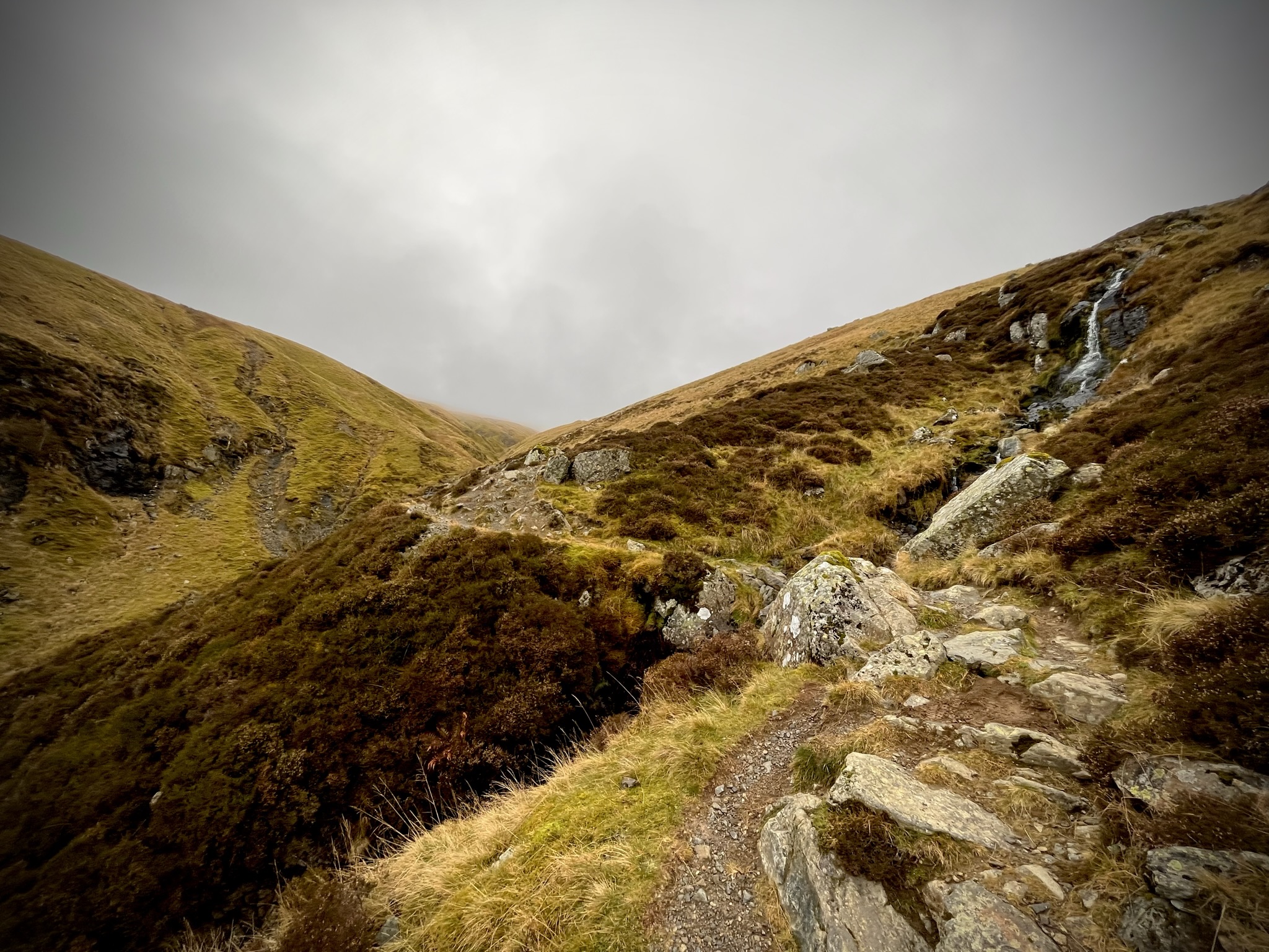
I reach and cross Swart Beck Footbridge and the beginning of Sticks Pass. Sticks Pass is fantastic. It's just the type of running I love: it's uphill, semi-technical in places, single track. It's just wonderful. I pause to take a photo and continue up, breaking into a hike as the gradient increases. I remind myself it's just a recce and that I don't need to push super-hard. It isn't long before I crest the high point of today's run, at 3.5 miles in, I've reached 2,500ft and Thirlmere comes into view... I start the deceptively steep and slippery descent to Sheepfold where I pick up the track to Swirls car park. I swap out an empty 500ml flask of Tailwind for a full one and continue on.
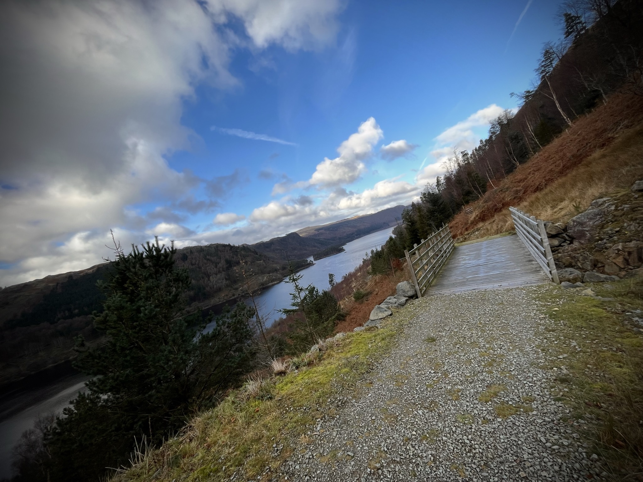
The section from Sheepfold to Dunmail Raise is reasonably flat... and Swirls to Red Brow is forestry road periodically punctuated with wooden bridges that span the wonderful waterfalls that cascade down from Helvellyn. It's easy running with the exception of one quite steep but short hill. But either end of the forestry road, the terrain is hard going: it's tough to get into a rhythm with so many little ups and downs, twists and turns, rocks here and there, obstacles, gates and all that stuff make for quite tiring running. I'm also reminded that my Altra Lone Peak 6 trail shoes provide absolutely no grip on wet rock... just a little slip on this occasion but a warning no less.
I soon spot the little spur off to the left which signals it's time for more up! I appear to startle a couple of hikers at Raise Beck who are consulting their map... "Oh hello! Are you going all the way up? We're not sure whether to cross over or not...", the lady asks. I see the gap in the stone wall on the other side of the beck and volunteer to go check it out. Despite attempting to keep dry and look cool, I slip into the freezing cold water but thankfully manage to stay upright. All looks good the other side of the wall, it looks right. I give the thumbs up and wish the two hikers a good day before scampering off up the ascent to Grisedale Tarn.
Whilst not overly steep, I hike rather steadily up Raise Beck: the rock is pretty slippery in places and I had started to feel a little queasy... perhaps a sign I'm pushing too hard or not taking in enough calories... either way I decide to take it easy all the way up. As I get closer to the top of Raise Beck, the temperature drops but I don't feel the need to stop and layer up... I'm still warm enough in my single long-sleeved layer and my fancy-pants winter running tights.
Reaching Grisedale Tarn, I swap out another flask: I'd made up 1,500ml for the recce but on race day, I'll travel lightly and fill up at check points or from the many water sources on route.
I have a faff finding the line I'd plotted from the top of Raise Beck to the Boredale Head path. I'd clearly seen a good, straight trod on the aerial OS map between the two points but here and now I'm unable to find it... I end up wasting time traversing over quite boggy ground before I finally pick up the path.
The sections of wet rock on the way down to Boredale Head prove challenging to run over at speed: not a great spot for a fall, I note to myself, but I was approach two walkers heading in the same direction, I slip on one rock, kick another and accelerate forward completely off-balance and out of control... I just have enough time to emit that sound you make when you're facing imminent danger but somehow I manage to get one foot back underneath me and I hop, skip and dance my way to a safe standstill. I take a moment to let out a thankful expletive as I gaze sheepishly around, I am relieved to see the walkers are oblivious to my dancing. I breathe a sigh of relief before setting off... I have avoided not only embarrassment but also a helicopter ride off the fells.
I need to eat something, I reach for a banana and make short work of it as I carefully pick my way down to Boredale Head. Rocky ground turns to grit path, grit path turns to road and before I know it I'm heading back into Glenridding. Striding into the car park, I'm relieved to see my car and I stop my watch... 3 hours 36 minutes, 16 miles and 3,744ft of elevation gain. Not a bad little run at all.
Driving home I have time to reflect. I won't be able to recce the out-and-back section from Askham to Patterdale before race day so I'll need to study the map well and perhaps take a look at the routes other runners have taken in the past... all I know is that section is supposedly fast and runnable with only one noticeable climb just South of Place Fell. I also wonder how much colder it might get in the next couple of weeks: I had perfect conditions today with just a touch of rain towards the end but I have seen some very picturesque race photos from previous years with snow on the ground... the descent down to Sheepfold and also down to Boredale Head will be much trickier with ice and/or snow on the ground. I'm also wondering how hard I'll be able to push up the hills on race day with the additional distance and elevation in my legs. I'll just have to wait and see!
Comments